
Historical Overlay SA
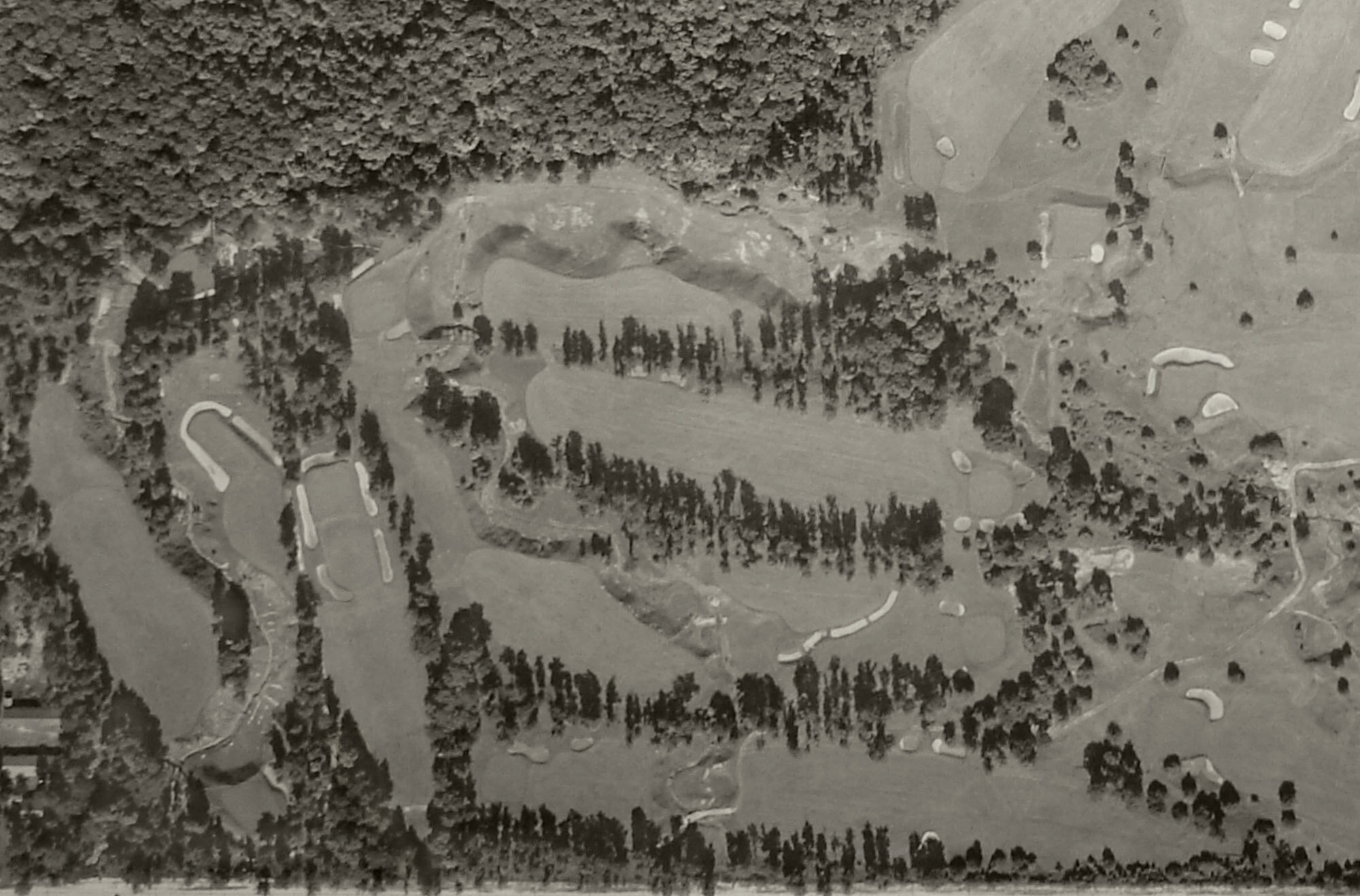
Step 1 - Historical Aerial Overlay
The first step in a historical analysis is to align the old aerial over the existing image, to scale.
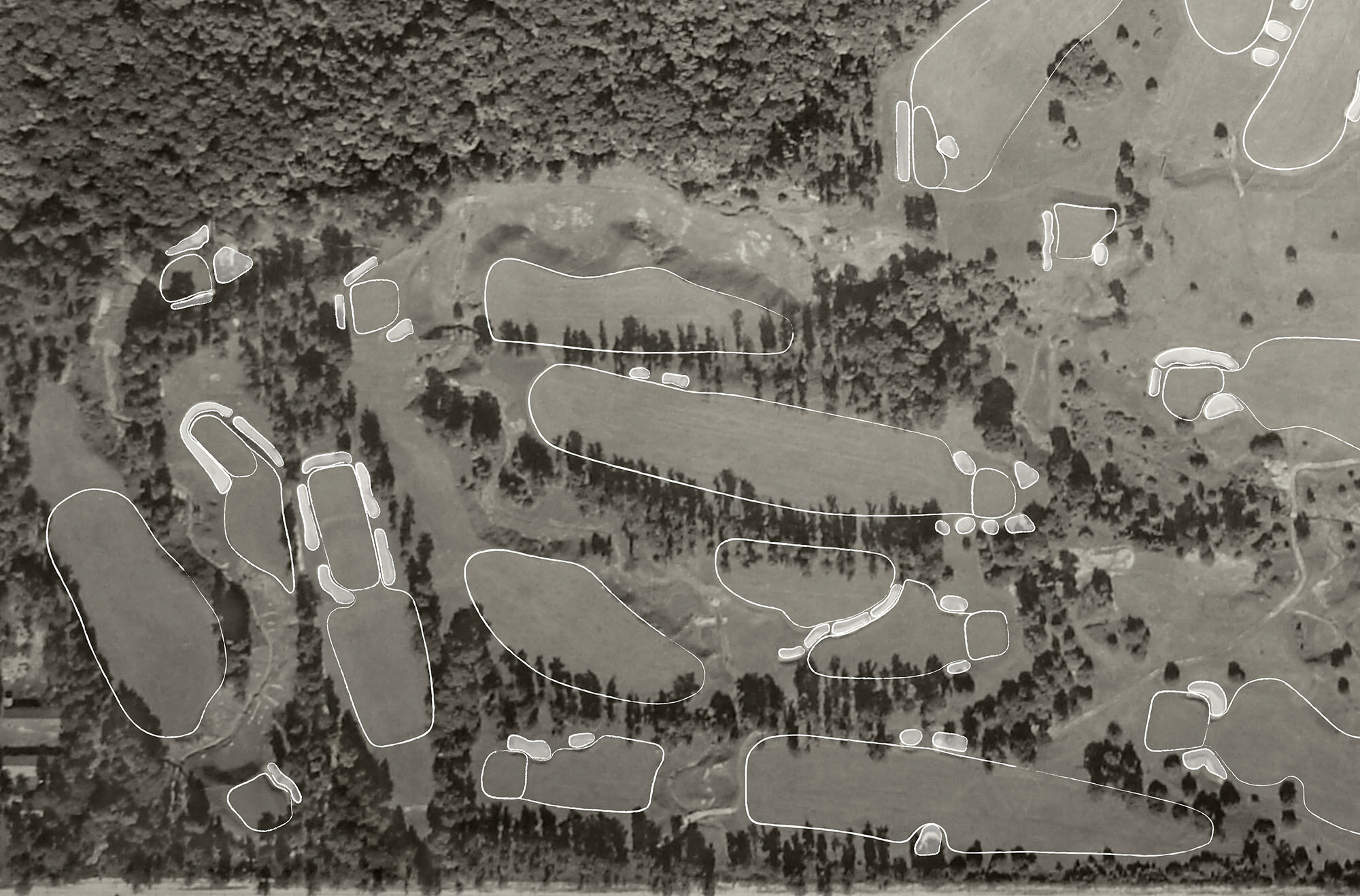
Step 2 - Feature Digitization
The aerial is then digitized in AutoCAD by tracing all visible golf course features, including: greens, tees, bunkers, lakes, streams, and tree canopies. The digitization process allows for takeoffs of these features in order to track the changes of feature size over time.
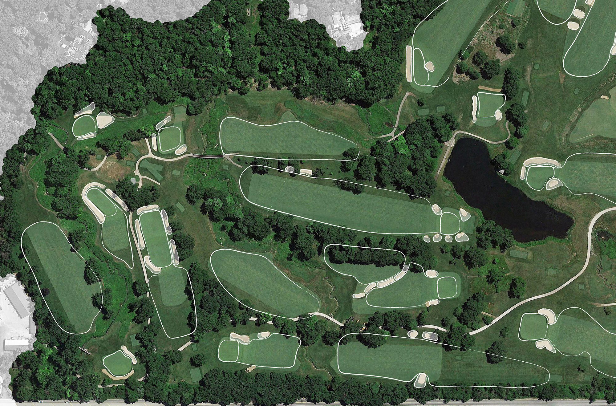
Step 3 - Final Image Overlay
After the historic golf features are digitized, a final image is created that shows the historic golf holes overlaid on a current aerial of the golf course. This allows clubs and green committees to easily recognize how the golf course has transition from its initial design to its current form.